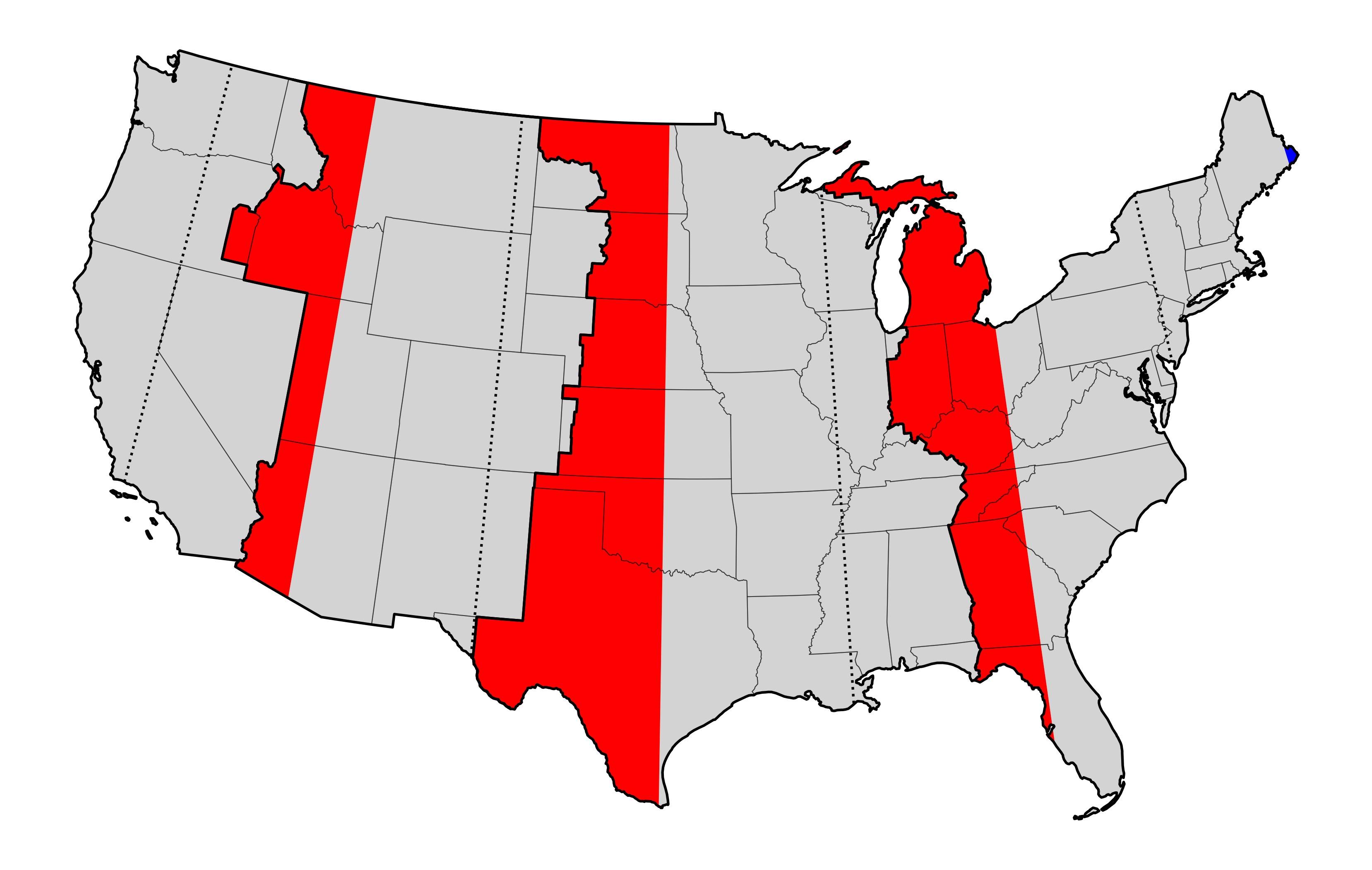
In yesterday’s post about sunrises, I made a snarky offhand comment about certain places being in the wrong time zone.
Today I drew a map that highlights the locations that are more than 7.5 degrees from the central longitude of their time zone. (US time zones are spaced every hour, which corresponds to 15 degrees of longitude.)
If you are in the correct time zone, then your average solar noon is between 11:30 a.m. (if you live on the far eastern edge) and 12:30 p.m. (on the far western edge) Standard Time.
A few states and parts of several others are clinging to the Eastern Time Zone when they should join Central. The Great Plains states and Western Texas should really join Mountain Time. My birth state of Idaho should observe Pacific Time.
Instead, these locations are all running 30-60 minutes later than they should be. And of course, if we do end up switching to full-time Daylight Saving Time, that will become 90-120 minutes, which seems pretty ridiculous to me.
Then again, they already spend two-thirds of the year in that condition, so this misalignment isn’t exactly new.
(You may notice that a tiny sliver of Maine is actually too far east for the Eastern Time Zone, but that one seems like not a big deal.)